Sample answer
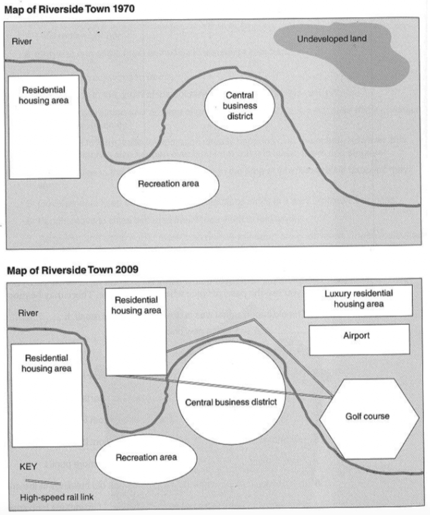
The two maps show changes that took place at a town called Riverside over a period from 1970 to 2009.
Overall, the town experienced great urbanisation with less open spaces, in which there was the development of residential area mostly and other modifications, including commercial facilities and transportation system.
The housing area witnessed an expansion on a large scale over the period given. In 1970, it was only one housing area located in the west of the town. However, the map of Riverside Town in 2009 shows two more newly-built residential areas. One was situated opposite the old one, across the river and the other was constructed north-east of the town as a luxury accommodation area, which was a replacement for the undeveloped land.
Turning to commercial changes in the town, it can be seen clearly that what was originally a small central business district (CBD) south of the river has been expanded to a much larger one by 2009. In addition, there was a golf course and a recreation zone built to the south of the river. Regarding the transportation-related development, an airport was constructed to the south of the luxury residential housing area. Apart from that is the construction of a high-speed rail link system connecting the newly-built housing area, the CBD and the golf course.
Word count: 215 words
Giáo viên Be Ready IELTS - Ms Thi